A map of the province of Upper Canada, describing all the new settlements, townships, &c. with the countries adjacent, from Quebec to Lake Huron. Compiled from the original documents in the Surveyor General's Office. Image Read more about A map of the province of Upper Canada, describing all the new settlements, townships, &c. with the countries adjacent, from Quebec to Lake Huron. Compiled from the original documents in the Surveyor General's Office.
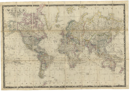
The world, on Mercator's projection. By James Wyld, geographer to the Queen. London, published by James Wyld, Charing Cross Image Read more about The world, on Mercator's projection. By James Wyld, geographer to the Queen. London, published by James Wyld, Charing Cross
The province of Canada by James Wyld geographer to the Queen and HRH Prince Albert. Charing Cross East London. Read more about The province of Canada by James Wyld geographer to the Queen and HRH Prince Albert. Charing Cross East London.
The United States of North America, with the British territories. London. Published by Jas. Wyld, successor to Mr. Faden geographer to Her Majesty, Charing Cross East 1845 Read more about The United States of North America, with the British territories. London. Published by Jas. Wyld, successor to Mr. Faden geographer to Her Majesty, Charing Cross East 1845
[Western Hemisphere, Eastern Hemisphere, Southern Hemisphere, and Northern Hemisphere] Read more about [Western Hemisphere, Eastern Hemisphere, Southern Hemisphere, and Northern Hemisphere]
A new map of the province of Lower Canada, describing all the seigneuries, townships, grants of land &c. Compiled from plans deposited in the Patent Office Quebec, by Samuel Holland, esqr. surveyor general Image Read more about A new map of the province of Lower Canada, describing all the seigneuries, townships, grants of land &c. Compiled from plans deposited in the Patent Office Quebec, by Samuel Holland, esqr. surveyor general
A map of the province of Upper Canada, describing all the new settlements, townships, &c. with the countries adjacent, from Quebec to Lake Huron. Compiled from the original documents in the surveyor general's office. Image Read more about A map of the province of Upper Canada, describing all the new settlements, townships, &c. with the countries adjacent, from Quebec to Lake Huron. Compiled from the original documents in the surveyor general's office.
Map of North America, exhibiting the recent discoveries. Geographical & nautical. By James Wyld, geographer to Her Majesty. Image Read more about Map of North America, exhibiting the recent discoveries. Geographical & nautical. By James Wyld, geographer to Her Majesty.